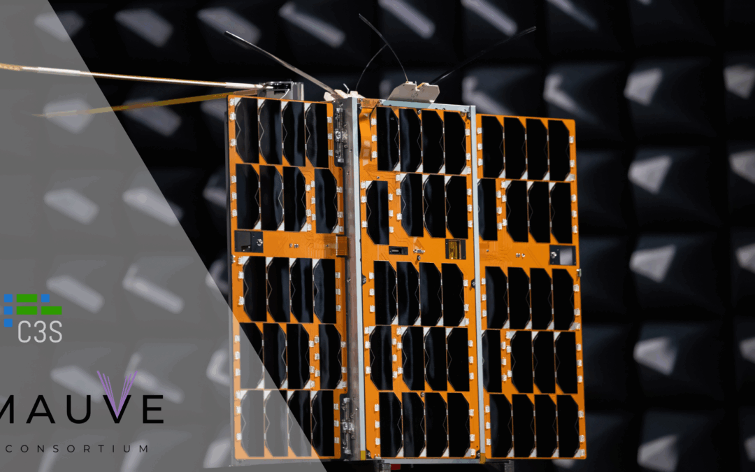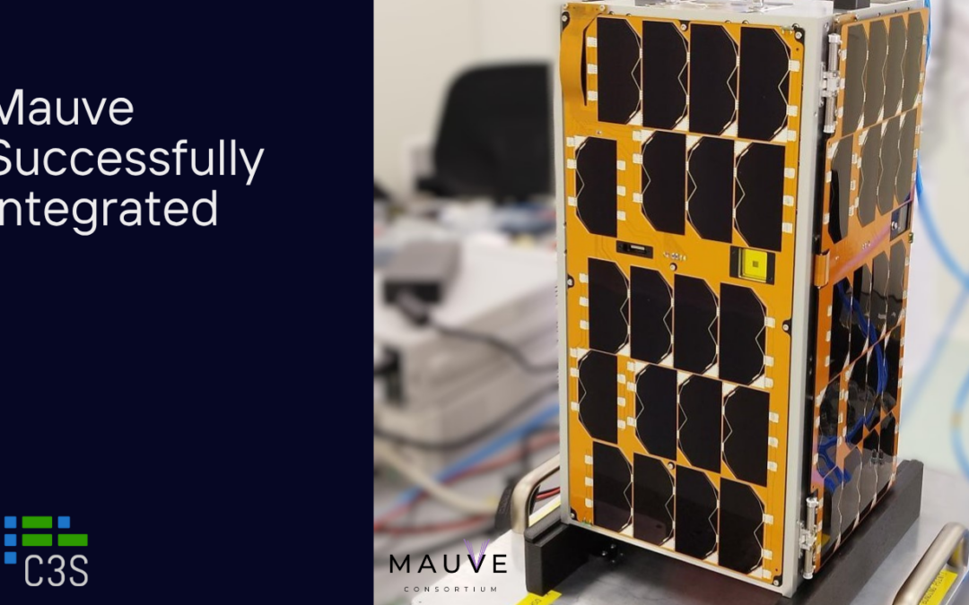
Our 3U CubeSat satellite, VIREO (Virtual Intelligence Realization for Earth Observation),
launched on 15 April 2023, is completing its mission today. The aim of the project, an internationally unique achievement, was designed to put artificial intelligence into space, extending its in-flight processing capabilities. It provided a good opportunity to gain experience with the technology and thus to exploit the benefits of this innovative technology in other applications in the future.
VIREO’s mission shaped the future where AI technology advance our understanding of the space.
The launch of VIREO was special in itself. It spent more than a month aboard the Momentus Vigoride-6 launch vehicle to find the most optimal orbit. The launcher successfully reached its target, the ejection was unobstructed, and VIREO immediately settled into its optimal orbit and, after powering up its subsystems, continued its Earth observation experiments without a hitch.
VIREO’s on-board demonstration experiments have been running for months with excellent results, from the very beginning of the space experiments, the on-board AI algorithm successfully pre-selected the images that the system sent back to Earth.
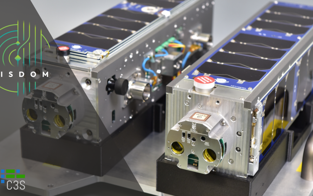
A number of space experiments have been carried out on board VIREO, including a joint development with the aiMotive team. This involved processing image data captured by the satellite’s cameras in space using AI-based image processing algorithms. This demonstration was also an innovative technology transfer, as we integrated an automotive hardware accelerator, aiWare, into the satellite. Another significant experiment was the on-board run of an AI-enabled software algorithm suite from KP Labs in Poland, which learned on-board cloud detection and cloud mask generation using VIREO on-board images after reconfiguring the neural network.
A new feature on the satellite is that, in addition to the experiments already presented, we have also tested a payload control subsystem of our own design in the 10 × 10 × 10 cm cargo bay. This will support future CubeSat projects by simplifying and speeding up integration and providing outstanding on-board computing capacity for the various sensors and experiments. We are also prepared for future Earth observation missions.
We have also demonstrated several imaging techniques with four different types of cameras in space. For example, we have demonstrated that the satellite can capture images by focusing on a point on the ground and tracking it as it moves in orbit. We have also taken ground target tracking and burst shooting images and developed automated image acquisition processes for Earth-observation purposes.
During its 16-month mission, CubeSat captured breathtaking images. These stunning images of the Earth from space provides a unique perspective of our planet that also shows its fragile beauty.
Although the mission is over, the success of VIREO has proven that artificial intelligence technology can make earth observation faster and more efficient, which can mean advances in sectors such as agriculture, disaster management, and energy extraction.
Images from space can be used to quickly and accurately track changes in the earth’s surface and unexpected events. In addition, its further development could pave the way for areas such as better coordination of satellite fleets, bringing the internet to remote areas, space mining, reducing space debris or the success of very distant space missions.
Today, on 7th August 2024 morning, the satellite will deorbit over New Zealand at 11:39am, reach our atmosphere and will be destroyed forever.
New platform capabilities demonstrated in VIREO mission:
Within 1U payload bay:
- 2 general-purpose, AI-capable Single-Board Computers designed from scratch
- 2 × SpaceWire + 1 × Gigabit Ethernet links (harness-based)
- 2 × automotive GMSL + 2 × commercial JPEG camera systems in 2 different lens configurations
- AI-related IODs: cloud-detection capabilities demonstrated using:
- NextChip’s Apache5 SoC with aimotive’s aiWare CNN accelerator
- KP Labs’ „The Herd” AI-based algorithm collection
Technological advancements in C3S’ portfolio:
- Hardware: System-on-module, System-on-Chip, high-density storage, high-speed serial links, and FPGA integration
- Software: combined FreeRTOS & Linux-based OBDH approach, adaptive payload-handling mechanism
- FPGA: first mission of an in-house developed soft-processor system incl. ≈30 proprietary IP cores
- Mechanical engineering: 3D-printed camera support structure
- Operation: fully automated image acquisition processes for Earth-observation purposes
- random thumbling
- ground target tracking
- burst shooting (in nadir direction or with an automatically calculated roll angle)
Our NEXT space mission is coming soon!In a few days we will launch our largest satellite, the 6-unit WREN-1. More details coming soon.
VIREO küldetés teljesítve
A VIREO (Virtual Intelligence Realization for Earth Observation) nevű 3U CubeSat műholdunk, amelyet 2023. április 15-én indítottunk útnak, ma befejezi küldetését. A nemzetközi szinten is egyedülállónak számított misszió célja, a mesterséges intelligencia űrbeli használata volt, kiterjesztve annak repülés közbeni feldolgozási képességeit. Ez jó lehetőséget biztosított arra, hogy tapasztalatokat szerezzünk a technológiával kapcsolatban, és így a jövőben más alkalmazási területeken is kiaknázzuk az innovatív technológia előnyeit.
VIREO küldetése a jövőt készítette elő, ahol a mesterséges intelligencia-technológia a világűr megértésében nyújt segítséget.
A VIREO-nak már a pályára állítása is különleges volt. Több mint egy hónapot töltött egy orbitális szállítóeszköz fedélzetén, hogy megtalálja az legoptimálisabb pályát. A hordozóeszköz sikeresen célba ért, a VIREO pedig azonnal ráállt a számára optimális pályára, és alrendszereinek beüzemelését követően zökkenőmentesen folytatta földmegfigyelő kísérleteit.
A VIREO demonstrációs fedélzeti kísérletei hónapokon keresztül kiváló eredményekkel zajlottak, már az űrkísérletek kezdetétől a fedélzeti AI algoritmusa sikeresen előválogatta a képeket, amelyeket a rendszer leküldött a Földre.
Számos űrkísérlet történt a VIREO fedélzetén, amelyek közül kiemelendő az aiMotive csapatával közös fejlesztés. Ebben a műhold kamerái által rögzített képi adatokat dolgoztuk fel az űrben AI alapú képfeldolgozó algoritmusok segítségével. Ez a demonstráció egyben innovatív technológiai transzfer is volt, hiszen egy autóipari hardvergyorsítót, az aiWare-t integráltuk a műholdba.
Egy másik jelentős kísérlet a lengyel KP Labs mesterséges intelligenciával támogatott szoftveralgoritmus-csomagjának fedélzeten történő futtatása volt, amely a VIREO fedélzeti képeinek segítségével, a neurális háló újrakonfigurálását követően tanulta meg a fedélzeti felhődetektálást és a felhőmaszk előállítást.
Újdonság volt a műholdon, hogy a 10 × 10 × 10 cm-es raktérben, a már bemutatott kísérleteken felül, egy saját fejlesztésű payload-vezérlő alrendszert is kipróbáltunk. Ez a jövőbeli CubeSat projekteket fogja támogatni azzal, hogy egyszerűbb és gyorsabb lesz az integráció, és kiemelkedően nagy fedélzeti számítási kapacitást biztosít a különböző szenzorok és kísérletek számára. Emellett felkészültünk a jövőbeli földmegfigyelő küldetésekre is.
Az űrbe juttatott négy különböző típusú kamerával demonstráltunk számos felvételkészítési módszert is. Például bizonyítottuk, hogy a műhold képes egy földi pontra fókuszálva, azt pályán való mozgása közben lekövetve felvételt készíteni. Emellett készítettünk sávfelvételeket és pásztázó mozgással készült felvételeket is, valamint kidolgoztuk a földmegfigyelési küldetések üzemeltetését megkönnyítő, automatizált képfelvételi metódusokat.
A CubeSat 16 hónapos küldetése során lélegzetelállító képeket készített a Föld különböző részeiről. Ezek a lenyűgöző űrfelvételek egyedülálló perspektívát nyújtanak bolygónkról, bemutatva annak törékeny szépségét is.
Bár a küldetés véget ért, a VIREO sikere bebizonyította, hogy a mesterséges intelligencia technológiájával gyorsabbá és hatékonyabbá válhat a földmegfigyelés, amely többek között olyan ágazatokban jelenthet előrelépést, mint a mezőgazdaság, katasztrófavédelem, vagy energiakitermelés.
Az űrből érkező felvételekkel gyorsan és pontosan követhetőek a földfelszín változásai és a nem várt események. Ráadásul a módszer továbbfejlesztése olyan területek felé is utat nyithat, mint a műholdflották jobb összehangolása, az internet távoli vidékekre való eljuttatása, az űrbányászat, az űrszemét csökkentése vagy a nagyon távoli űrös küldetések sikere.
A műhold a mai napon, 2024.08.07-én délelőtt 11:39-kor az Új-Zéland felett deorbitál, eléri légkörünket és végleg megsemmisül.
A VIREO küldetés során bemutatott új platformképességek:
1U méretű hasznos teher térben:
- 2 általános célú, MI-képes Egykártyás Számítógép (nulláról megtervezve)
- 2 × SpaceWire + 1 × Gigabit Ethernet kapcsolat (kábeles)
- 2 × autóipari GMSL + 2 × kereskedelmi JPEG kamerarendszer 2 különböző objektív konfigurációban
- Mesterséges intelligenciával kapcsolatos IOD-k:
a felhő-felismerési képességek demonstrálása a következő eszközökkel:
1. NextChip Apache5 SoC a aimotive aiWare CNN gyorsítóval.
2. KP Labs “The Herd” mesterséges intelligencia-alapú algoritmusgyűjteménye.
Technológiai előrelépések a C3S portfóliójában:
- Hardver: System-on-modul, System-on-Chip, nagy sűrűségű tárolás, nagy sebességű soros kapcsolatok és FPGA integráció.
- Szoftver: kombinált FreeRTOS és Linux-alapú OBDH megközelítés, adaptív hasznos teher kezelési mechanizmus.
- FPGA: egy saját fejlesztésű soft-processzoros rendszer első küldetése, amely ≈30 saját fejlesztésű IP-magot tartalmaz.
- Gépészet: 3D nyomtatott kameratartó szerkezet
- Működés: teljesen automatizált képalkotási folyamat Föld-megfigyelési célokra
1. Véletlen bolyongás
2. Földi célpont követése
3. sorozatfelvétel (nadír irányba vagy automatikusan kiszámított gördülési szöggel)
HAMAROSAN jön a következő űrmissziónk!
Napokon belül indítjuk útnak a legnagyobb műholdunkat a 6 unitos WREN-1. További részletek hamarosan jönnek.